Kazakhstani startup Seer Labs is developing PHESTRA, a predictive hydrological engine designed to identify early indicators of river drought. In an interview published by Kapital.kz on October 9, co-founder Olzhas Ospanov stated that historical validations achieved advance warnings of 1.5 to 3 months. Such forecasting runway enables agrarian planning, revised reservoir storage schedules, and preemptive water allocations before crisis thresholds occur.
For Kazakhstan, water resilience is an urgent strategic imperative. In September 2026, the UNDP reiterated that the country could face an annual structural deficit of 12 to 15 billion cubic meters by 2040. While this metric models long-term climate risk rather than current shortfall, resource allocation choices must be operationalized immediately.
Seasonal Volatility: Spring Floods vs Summer Scarcity
A river basin may experience heavy spring runoff, only to drop below minimum irrigation discharge months later. For reservoir managers, this creates dual competing priorities: maintaining buffer capacity for flood mitigation while conserving reserves for arid summer irrigation. Suboptimal decisions on one side compromise the other.
Regional transboundary dependencies compound management complexity. In its 2024 annual review, the Ministry of Water Resources estimated Kazakhstan’s long-term average surface runoff at 106 billion cubic meters, with 44.3% originating across international borders in China, Uzbekistan, Russia, and Kyrgyzstan. This reflects historical hydrological baselines rather than a specific single-year allocation.
Tangible trade-offs emerged ahead of the 2026 planting season. During a cabinet briefing on May 12, 2026, the Water Ministry reported depleted storage levels in Kyrgyzstan’s Kirov and Orto-Tokoy reservoirs. Across the Shu-Talas basin, Kazakhstan’s authorized irrigation withdrawal ceiling was reduced from 1.2 billion to 900 million cubic meters—a 25% supply contraction.
If farmers receive notification of water rationing after planting, operational pivots are nearly impossible. Input capital has been deployed and seed stocks sown. Early predictive signals allow farm operators to adjust crop rotation and acreage before deploying capital.
Predictive Mechanics: What PHESTRA Analyzes
According to the development team, PHESTRA evaluates composite hydrological risks. The neural architecture ingests river gauge discharge measurements, water elevation telemetry, meteorological precipitation data, ambient temperature trends, and soil moisture indices. Its primary function is diagnosing anomalous hydrological signals and flagging emerging dry patterns.
A crucial distinction must be drawn between river drought and localized irrigation scarcity. A verified projection of declining river flow does not alone answer whether municipal utilities or farming districts will experience shortages. Operational availability depends upon reservoir storage, downstream demand, canal throughput capacity, and administrative allocation protocols.
Consequently, the primary utility of such software lies in generating structured risk advisories that allow hydrologists to model mitigation pathways. For agricultural producers, actionable value materializes when river forecasts translate into predictable delivered cubic meters.
Model Performance: 15 Historical Low-Flow Events on the Sokh River
According to Ospanov, backtesting against historical gauge archives on the Sokh River identified all 15 historical low-flow anomalies with an advance window of one to three months. The company also reported testing across more than 4,000 river basins across 23 countries. In high-flow and flood modeling, prediction horizons averaged approximately five days.
These benchmarks represent self-reported startup performance. While retrospective backtesting validates algorithmic potential, identifying 15 past historical events does not guarantee 100% predictive reliability. A complete performance profile requires published false alarm rates—how often the model signaled drought when none materialized. This metric was omitted from public interviews.
Rigorous independent verification requires confirming that the model only accessed data available prior to each prediction date, while benchmarking accuracy gains against established hydrological physics models. Lacking this rigor, impressive retrospective fits often experience performance decay during real-time forward deployment.
Acreage Reductions: Rice Production Cut by 21,600 Hectares
Kazakhstan actively curtailed agricultural acreage in 2026 to conserve scarce water reserves. In a September briefing, Water Resources Committee Chairman Seyilbek Nurymbetov confirmed that national paddy rice cultivation was reduced from 100,500 to 78,900 hectares, concentrated primarily across the Kyzylorda and Turkistan regions.
Existing Digital Hydrological Implementations in Kazakhstan
PHESTRA enters an institutional environment where enterprise hydrological modeling is already advancing. An official government review from September 3, 2026, highlighted joint testing with the UNDP of the German TALSIM-NG hydrological platform. Covering eight major river basins, TALSIM-NG calculates streamflow, reservoir inflows, and drought scenarios, powering the Tasqyn flood risk system.
The review also noted that Kazakhstan’s National Water Information System has digitized data for over 23,000 hydrological assets. This geospatial database provides foundational architecture, though record counts alone do not guarantee the real-time sensor quality of active telemetry.
Field implementations show operational impact. UNDP Technical Advisor Hubert Lohr reported in June 2025 that pilot platforms across the Yesil and Nura-Sarysu basins incorporated TALSIM, Delft-FEWS, and QAZSU. In March, models successfully projected flood points near Atbasar and Kalkutan, validated in early April. Lohr emphasized that transmitting intelligible, early warnings to operational teams remains critical.
This underlines the post-calculation challenge: who ingests the predictive telemetry, who validates the model, and who executes real-time reservoir adjustments. Accurate predictions yield minimal utility if not backed by operational protocols.
International Parallels: Google Flood Forecasting
Globally, predictive environmental AI operates at broad scale. Google Research operates a riverine flood forecasting system covering over 150 countries and regions inhabited by roughly 2 billion people, offering lead times of up to seven days. The architecture blends meteorological forecasting, gauge telemetry, and satellite radar imagery.
Direct comparisons between Google’s seven-day flood warning and PHESTRA’s three-month drought horizon must be contextualized carefully: short-term flood crests and seasonal drought represent distinct hydrological phenomena. Technology evaluation requires uniform benchmark conditions: identical risk classifications, paired river basins, and standardized error metrics.
Physical Infrastructure Demands Ongoing Capital
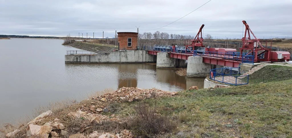
Hydrological shortfalls stem from physical constraints that software cannot solve alone. National infrastructure plans target construction of 42 new reservoirs and the modernization of 14,500 kilometers of distribution canals. These represent planned capital projects rather than commissioned facilities.
During the May 12 cabinet meeting, the government announced increasing budget appropriations for water-saving tech subsidies and irrigation tariffs to 228.1 billion KZT for 2026–2028, compared to 55.5 billion KZT allocated over the preceding three-year cycle.
Predictive analytics optimize where reserves must be impounded and when extraction must be curtailed. Physical conveyance to agricultural fields depends on canal linings, pumps, and metering stations, while transboundary agreements require diplomatic coordination.
Real-World Verification Through In-Season Performance
For PHESTRA, the definitive proof point will be prospectively validated forecasts logged prior to upcoming seasonal runs. That forward data will enable audited measurements of misses, false positives, and accuracy gains over legacy methods. Practical efficacy will be demonstrated by whether irrigation managers successfully modulated reservoir discharge based on early software advisories.
Kazakhstan requires digital intelligence that buys planning time. When warnings arrive prior to planting or reserve drawdown, basin managers and growers gain operational flexibility. The long-term promise of multi-month predictive AI should be evaluated against these concrete decisions.
Managing water risk also raises the question of financial protection when adverse weather strikes. How satellite Earth observation and AI are deployed across parametric agricultural insurance was examined in our report “A View from Orbit Shields Earthbound Risks.”